The Iles Éparses (Scattered Islands)Location/ Description/ Glorieuses/ Juan de Nova/ Bassas da India/ Europa/ Jurisdiction/ Features of Potential Outstanding Universal Values/ Threats/ Management status/ Geographic scale and site integrity/ Other sites in the region / Key References
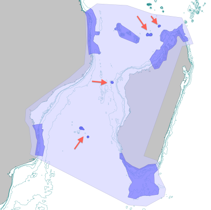
Location - The “Scattered islands” (literal translation of “les Iles Éparses”) stretch down the length of the Mozambique Channel, between the east coast of Africa and Madagascar. Glorieuses island (11.3°S) and Geyser bank, close to Mayotte, are in the north, Juan de Nova is in the center, adjacent to the Madagascar coast, and Bassas da India and Europa (22.4°S) are in the south. Description - They Iles Éparses are an administrative unit rather than a single geological unit, with the northern banks (Glorieuses and Geyser) likely being extensions of the Comoros archipelago, while the middle and southern islands are distinct geological features. Their geological history combines aspects of basaltic magma extruded through remnant fracture zones in the channel floor, as well as volcanic activity and the production of seamounts. In the north, Geyser and Glorieuses are likely extensions of the Comoros archipelago formed by a hotspot, and intermediate in age between Mayotte and volcanic activity in northern Madagascar (e.g. Montagne d’Ambre), about 10 my old.
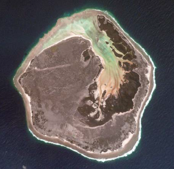
Juan de Nova is a small coral island (about 6 km²) on a 250 km² coral reef platform. It consists of beachrock and sand dunes up to 12 m in height. The coral structures extend 12 km north and 2 km south of the island. The asymmetry of the reef bank, linked to the tilting of the island results in different reef morphologies: in the south the island has a well defined reef flat between 0 and 3 m depth, while in the north it slopes down slowly to 20 m deep before dropping to >2000 m to the channel bottom. On the island, phosphate deposits in the form of guano were exploited from 1900 to 1968. Bassas da India is a subcircular atoll 12 km in diameter, with a shallow sandy lagoon and is almost entirely submerged at high tide. The atoll is currently growing and the reef slope is very steep, dropping to 3000 m to the bottom of the Mozambique Channel. Europa is a raised atoll of 6-7 km in diameter and 28 km² area, a remnant of a Pleistocene atoll from 125,000 years ago. The island is a low sandy cay surrounded by a small cliff of raised dead coral, interrupted by sandy beaches. A dune fringe, to a maximum height of 6 to 7 m, in places is up to ten meters wide. The shallow inner lagoon, in the process of filling, covers about 900 ha with some 700 ha of mangrove, communicating with the sea via an underground karst system and a reef spillway covered by seagrass. Jurisdiction - The Iles Éparses are under French jurisdiction, and since 2007 have been part of the French overseas territory called “French Southern and Antarctic Lands” (Terres australes et antarctiques françaises - TAAF), which also includes the southern islands of Crozet, Kerguelen Archipelago, St. Paul, Amsterdam and Terre Adelie. The EEZs of the Iles Éparses total 640,000 km2, and abut the EEZs of the neighbouring countries. The islands are subject to claims from these neighbouring countries, including Madagascar (Bassas da India, Europa, the Glorieuses islands and Juan da Nova) and from the Comoros for the Glorieuses islands. Features of Potential Outstanding Universal Values - The islands cover a broad latitudinal range and section through the Mozambique channel, giving them value together, in addition to the individual values of the islands.
Threats - The Iles Éparses are at not far from populated islands and the continental coastline, making them vulnerable to exploitation. Fisheries in the coastal waters surrounding the islands is banned but does occur by commercial boats, as well as recreational and small-scale targeting of reef fish, by fishers from e.g. Mayotte or South Africa, depending on the island. Moderate shipping traffic passes through the Mozambique channel, thus there is a pollution risk from tankers. Two petroleum exploration permits wihin the EEZs of the Iles Éparses were approved in December 2008, and exploration in the EEZs of neighbouring countries may have spillover impacts in the islands. As with other sites, climate change is a significant threat, with the added uncertainty of how changing water temperatures and currents will affect the dynamic eddies in the Mozambique channel that influence these islands in areas such as connectivity, primary productivity, prey populations for higher order predators, and fishing stock dynamics. Management status - Europa, Bassas da India, and Glorieuses were declared Nature Reserves in 1975 (arrêté préfectoral de 1975), and there is a permanent presence on the islands, for military and/or civil (meteorology) purposes. As a result, access to the islands is strictly and effectively controlled, with permits only being given for research. In support of this, a Scientific Committee of the Scattered Islands (CSIE) has been established, as an advisory body to the administration. In 2012, the whole the EEZ of Glorieuses was declared an MPA, and steps are underway to declare Europa as a national natural reserve. Europa was designated a Ramsar site in 2011. Geographic scale and site integrity – While the individual islands are all small, as a group they cover a large geographic range across the whole of the Mozambique channel. This property gives them a natural identity as a serial site. The integrity of the serial/island group is very high as the islands are uninhabited and human pressure very low. All studies show that marine habitats are in good health despite recent climate change impacts, and the composition of the trophic chain, with abundance of top predators is a sign of good health. Nevertheless, each island has a distinctive character, and provided the productivity and dynamics of open sea areas that are critical for feeding and migration remain in good condition, each island has a high integrity. Other sites in the region - The islands are unique in the region. Key References – Battistini (1996); Belkin Cornillon (2007); Caceres (2003); Chabanet & Durville (2005); --> References |
|||||||||
 |
Assessing potential World Heritage marine sites in the Western Indian Ocean |
 The Iles Éparses in the Mozambique channel; from north to south - Glorieuses, Geyser, Juan de Nova, Bassas de India and Europa


 Europa (left), Juan de Nova (middle), Geyser (right)
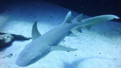
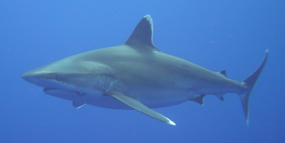
 The remote Iles Eparses are among the last refuges for many sharks, including the silvertip shark (above) and tawny shark (below).